
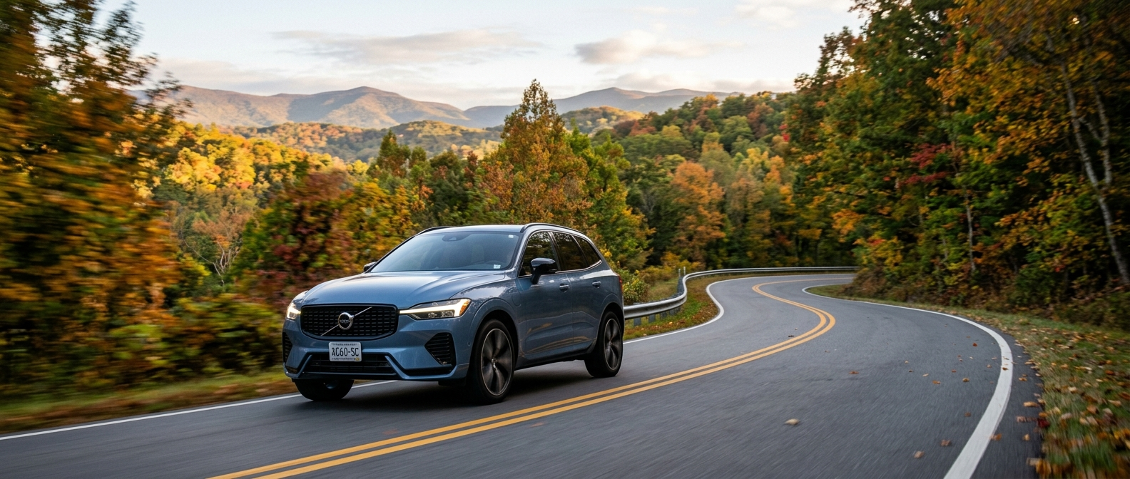
The plan starts with something we want to say plainly. City Safety isn't autopilot. It will not drive for you. What it will do is watch every gap, every pedestrian stepping off a curb, every deer that walks onto a Blue Ridge shoulder before you can process it, and intervene with layered precision if you don't react in time. Understanding how that layering works matters far more than reading a spec sheet. So we built a route.
Around Greenville, this is a real day drive. The 2026 Volvo XC60 anchors it. Each leg puts City Safety into a situation you'll actually face around here. Four stops, close to 100 miles, one system doing what it was designed to do all day long.
What's the Route?
The itinerary runs from downtown Greenville up through Paris Mountain, out along SC-11 Cherokee Foothills National Scenic Highway, and into the Mountain Bridge Wilderness Area near Caesars Head and Raven Cliff Falls. City traffic, a tight state-park climb, a rural two-lane corridor, a mountain overlook. Each stretch activates a different aspect of City Safety in a way a spec sheet never quite captures.
| Stop | Drive Time from Previous | What City Safety Is Doing | What to Bring |
|---|---|---|---|
| Start: Downtown Greenville (Falls Park) | n/a | Intersection autobrake; pedestrian and cyclist detection in stop-and-go | Reusable water bottle; parking plan |
| Stop 1: Paris Mountain State Park | ~15 min via I-385 N | Monitoring close following distances on the uphill grade; rear cross-traffic alert at the trailhead lot | Day-use fee (card accepted); trail shoes |
| Stop 2: SC-11 Cherokee Foothills National Scenic Highway | ~35 min via US-276 W | Forward collision warning across full speed range; large-animal detection on rural stretches | Snacks; sunglasses for afternoon western sun |
| Stop 3: Caesars Head / Raven Cliff Falls | ~20 min along SC-11 | Autobrake standby on sharp descents; pedestrian detection at the crowded overlook lot | Layers for the elevation drop; trekking poles optional |
| Return: I-385 and I-85 back to Greenville | ~50 min | City Safety and adaptive cruise working together in highway merge zones | Something to eat; energy to stay focused |
The Stops, and What the System Is Actually Doing at Each One
Stop 0: Downtown Greenville
You're pulling out of the Falls Park area on a Saturday morning. Cyclists come off the Swamp Rabbit Trail. Pedestrians step off Liberty Bridge. Rideshares double-park on Main Street. City Safety was built around exactly this environment.
The system pairs a forward-facing camera with radar to detect not just vehicles but pedestrians and cyclists. When it identifies a possible collision, it follows a set escalation sequence. First an audio and visual alert, then a vibration through the brake pedal itself, then autobrake if you haven't responded. That brake-pedal pulse is a detail you won't know about until you feel it the first time. Volvo's support documentation describes the autobrake as "brief, forceful braking," intentionally sharp so drivers don't grow complacent about the assist. The pulse is meant to be unmistakable.
Browse our current 2026 XC60 inventory and you'll see City Safety listed on every trim, standard equipment, full stop.
Stop 1: Paris Mountain State Park
The climb to Paris Mountain on Altamont Road is short but genuine. Grades tighten, the road narrows, and cars coming downhill can appear at blind curves with almost no warning distance. City Safety's forward collision warning stays active from roughly 20 to 120 mph, per IIHS documentation of the system's operating range, which means it's fully engaged on a 30-mph park road the same way it is on I-385.
What changes at lower speeds is what the system can prevent. Below about 37 mph, City Safety can stop the vehicle before impact. Above that threshold, it works to scrub speed and reduce the severity of a collision it can't prevent entirely. There's no need to apologize for that. The physics are honest, and we'd rather you know the distinction before the drive than during it.
At the parking lot, Cross Traffic Alert with Autobrake takes over when you reverse. If a cyclist or vehicle crosses behind you while you're backing out, the system warns first and brakes if you don't respond.
Stop 2: SC-11 Cherokee Foothills National Scenic Highway
SC-11 ranks among the genuinely beautiful drives in South Carolina. It runs as a two-lane rural corridor where white-tailed deer step onto the shoulder without warning, especially in the late-summer-into-fall transition. City Safety detects large animals. Large-animal detection is a stated category, built into the sensor array of cameras, radar, and lidar working together. Our Upstate drives put the deer risk right on SC-11 (the shoulder brush stays thick into fall), and that stretch is where the system earns its keep more than on any urban leg of today's route.
The IIHS found that City Safety reduces rear-end crashes by 41 percent and associated injuries by 48 percent. The IIHS described it as "highly effective... even on roadways with speed limits higher than the system's operating range." Those are real data points. We've seen the reaction when people read those numbers and assume they've been rounded up for a brochure. They haven't. The XC90 and the XC60 plug-in hybrid carry the same sensor suite. Detection capability doesn't vary by model in this lineup. Volvo makes that commitment deliberately across the range.
Timing note for SC-11 in fall: September through early November brings the best color on the Cherokee Foothills corridor, along with heavier weekend traffic, slower speeds at overlook pullouts, and more wildlife near the road. If you're driving this in the afternoon, plan to be off SC-11 before dusk. City Safety is watching. Dusk still isn't a smart call with heavy recreational traffic on the road.
Stop 3: Caesars Head and Raven Cliff Falls
The descent into Caesars Head State Park on US-276 drops steeply enough that City Safety's autobrake standby turns genuinely relevant. At the crowded Caesars Head overlook, you're maneuvering in a tight lot with hikers moving unpredictably around vehicles. Pedestrian detection is active.
The lot sits right off US-276. Hikers cross it all day.
The most important thing we tell drivers new to this system is simple. City Safety cannot help in every situation. Volvo states that plainly in its own documentation. It activates when the driver hasn't yet applied the brakes. If you've already braked, or if a scenario unfolds faster than any sensor can process, City Safety won't work miracles. It delivers engineering, and engineering has limits. Respecting that difference is what the system's designers intended, and it keeps drivers from treating the car as a substitute for attention rather than a last-resort backup.
What City Safety handles well at the Caesars Head lot:
- Slow-speed pedestrian detection as hikers cross through the parking area
- Cross Traffic Alert if you're backing toward the road while a car approaches
- Autobrake escalation if the vehicle rolls toward a barrier and you don't catch it
What it doesn't do is see through blind corners, override driver error already in motion, or make the judgment call about when to yield on a blind mountain road.
Return: I-385 and I-85 Back to Greenville
The merge zones where I-385 feeds toward I-85 are where City Safety works hardest in the final stretch. It monitors closing speeds in merge lanes, readies the brakes, and issues escalating alerts if a gap closes faster than expected. After a day that's included four hours of hiking, that layer of attentiveness matters. The system stays alert even when you're tired.
On Plus and Ultra trims, Pilot Assist, the adaptive cruise with lane-centering feature, complements City Safety on this highway return leg. They're separate systems with different jobs. Pilot Assist manages speed and lane position. City Safety handles the collision-avoidance layer. Both require your hands on the wheel and your judgment in the driver's seat.
Tweak It to Your Crew
With younger kids, we'd keep the route to Stops 1 and 3 and skip the full SC-11 corridor for now, since that stretch has limited facilities and the drive time adds up. Families that want more overlook time and less road time can start on SC-11 heading west from US-276, hit Caesars Head first, and make Paris Mountain the return leg back into Greenville. Either way, the full City Safety suite is running. It adjusts to the scenario, not to the route you've planned.
One honest note before you go. City Safety will occasionally flag a situation a confident driver would have handled without any alert. A car stopping quickly on a highway ramp. A pedestrian who stepped back onto the curb at the last moment. A merge lane that had more room than the radar could confirm from a distance. Early warnings are the system erring toward caution, which is the correct engineering choice. It can feel unnecessary in the moment. We're mentioning it now so it doesn't read as a malfunction when it happens, because it isn't.
The 2026 Volvo XC60 is on our lot with City Safety standard on every trim. If you want to feel the escalation sequence before you own one, come drive with us and we'll walk you through it in a controlled setting on Duvall Drive.
Volvo Cars Greenville is open Monday through Friday, 9 a.m. to 7 p.m., and Saturday, 9 a.m. to 6 p.m.
By the Volvo Cars Greenville Team | September 2026
Categories:
Social